Discoveries at Ancient Helike
|
In the winter of 373/372 BC, a violent earthquake struck the southwest shore of the Gulf of Corinth and destroyed and submerged the Classical city of Helike. Helike was founded in the Mycenaean period by Ion, the leader of the Ionian race and became the capital of the Twelve Cities of ancient Achaea. The patron god of Helike, Poseidon Helikonios, god of the sea and the earthquakes, was worshipped in his famous pan-Hellenic sanctuary located in the area of Helike (Katsonopoulou 1999). In the 8th c. BC, Helike founded Sybaris in South Italy, the most famous Greek colony of the West. The city of Helike remained important in the Archaic and Classical periods until it was destroyed and lost by the earthquake of 373 BC, widely discussed by many ancient writers (Katsonopoulou 2005a). Few decades before its destruction, Helike struck her own coinage. Three bronze coins of Helike are known --two in the Berlin Museum, a third recently auctioned in Vienna--, showing on the obverse a fine Classical head of Poseidon and on the reverse the trident flanked by two dolphins in heraldic position. Eratosthenes, a philosopher and mathematician of the 3rd c. BC, visited the area of Helike about 150 years after its destruction and talked with ferrymen who recounted to him the story of the bronze statue of Poseidon submerged in the poros. The term poros generally interpreted as indicating the Corinthian Gulf, was rightly re-interpreted by Katsonopoulou (1995) as referring to a lagoon formed in the area of Helike following the seismic event of 373 BC. The lagoon which Eratosthenes saw in the 3rd c. BC, had become partly dry land when the traveler Pausanias visited the site in the 2nd c. AD. In the remaining part of the lagoon, however, one could still see submerged ruins of the city, as Pausanias reports. The mention of submerged ruins in the area of Helike persists until the Middle Byzantine period (9th-10th c. AD). Today, the entire area of the ancient lagoon is completely covered under river-borne sediments.
The discovery of the lost city of Helike has been pursued by many archaeologists and researchers in the past. The most insistent attempt was made by the late Spyridon Marinatos between 1950-1973. Marinatos (1960) has stated that “with the excavation of Helice a great new light would be shed on both public and private life during the best period of Classical Greece”. Fifteen years after the end of the earlier inconclusive attempts, Dora Katsonopoulou (archaeologist) and Steven Soter (physicist) launched the Helike Project to locate and reveal the site of ancient Helike. First in 1988, an underwater sonar survey was carried out in collaboration with the oceanographer Paul Kronfield. The results showed no evidence of ruins of a city underwater. Consequently, since 1991 the search was shifted on land by using bore hole drilling (Soter & Katsonopoulou 1999). Since 1994 we employed geophysical surveys in collaboration with the University of Patras, the Radar Solutions International, the University of Oklahoma and the University of Thessaloniki (Soter & Katsonopoulou 2005). In 1995, excavations in the Klonis Field in Rizomylos brought to light a large Roman building, the first ever found in the coastal plain of Helike since the earliest research began in the middle of the 20th century (Katsonopoulou 1998).
Excavations
of the Helike Project
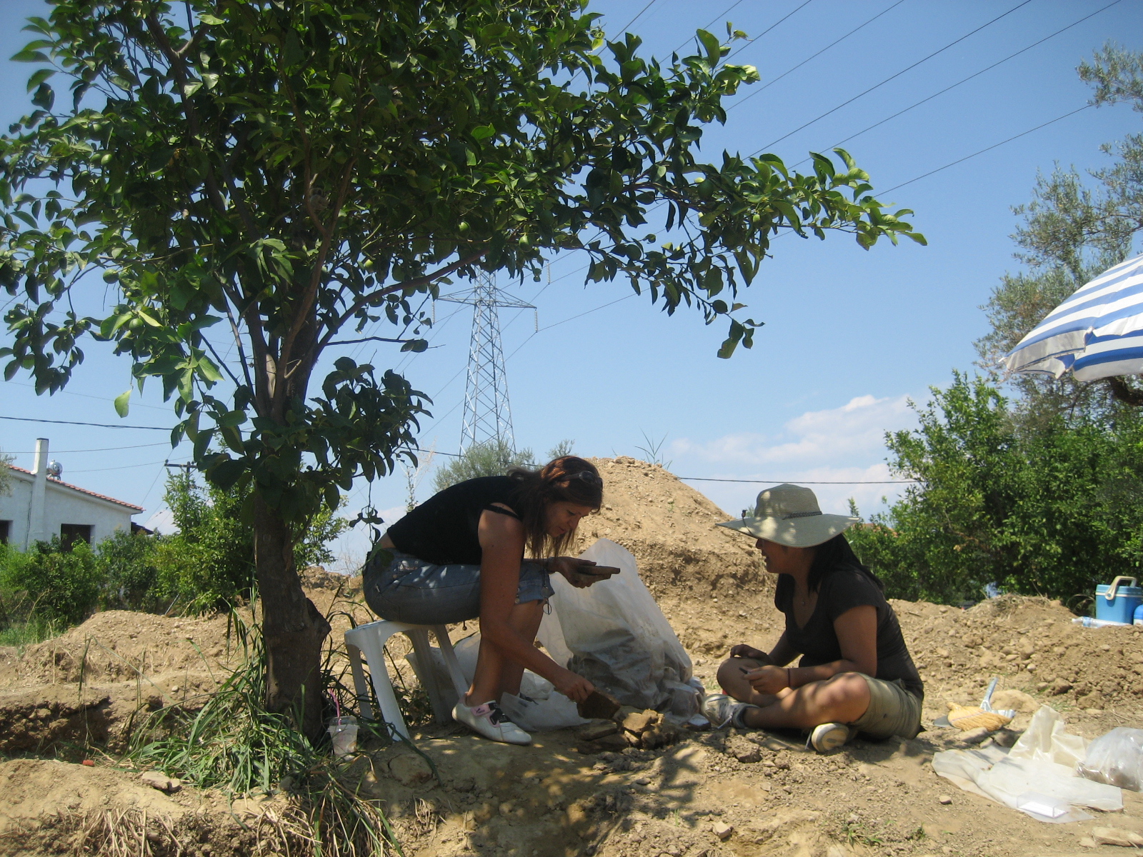
Systematic excavations of the Helike Project started in 2000. The first trial trenches opened on the basis of evidence from topographical studies, bore holes and geophysical surveys, revealed buried remains in various locations along the plain dated on the basis of the excavation finds to the Early Bronze Age, Late Bronze Age, Geometric, Classical, Hellenistic, Roman and Byzantine periods (Katsonopoulou 2005b and report below). Continuation of our excavations between
2001-2011 resulted in a number of important discoveries in the Helike area. The Early Helladic settlement. In the middle of our area of investigations, in the contemporary village of Rizomylos, we brought to light the remains of a well-preserved coastal EH settlement, the first ever found in Achaia. Large rectilinear buildings flanking the sides of cobbled streets, including a rare type of building known as “corridor house”, came to light preserving their rich contents, especially the pottery, intact. The assemblage of associated pottery includes a variety of shapes, such as two-handled bowls (kraters), pedestal-footed cups, cooking pots, narrow-necked jars, bass bowls, rim-handled and neck-handled tankards, flat-based cups, jugs, pyxides, wide-mouthed jars, one-handled and two-handled cups, and large pithoi decorated with finger-impressed, rope and overlapping disk bands decorations. Decorated pottery includes solidly painted and pattern-painted decoration Dark-on-Light with intersecting horizontal and vertical lines, zigzag, cross-hatching and paneled patterns. Incised “potter’s marks” were found on pottery fragments. Remains of seeds were found inside some of the recovered vases. Among the rich pottery assemblage, we also discovered a rare drinking cup, a depas amphikypellon, with an engraved symbol above its base. For the unique Helike Early Helladic depas cup, see Forsen J. (2010). Our EH finds also include pointed bone tools, stone tools, objects of obsidian and flint for cutting and scraping activities, and terracotta objects, such as spindle whorls and spools. We also collected a great number of sea shells and animal bones. Νew outstanding walls, 0.80 m wide, preserved to the impressive height of 1.10 m came to light with the 2011 excavations at the EH site in Rizomylos. Recovered pottery was once again amazingly abundant including complete vases (Fig. 9). Other finds from the excavated rooms include terracotta spindle whorls, stone tools, chipped stone artifacts, sea shells and animal bones. Among the most significant new finds from the EH settlement in 2011, we note an exceptional architectural feature found in one of the excavated rooms. It is a thick-walled, pi-shaped clay structure, 0.70 m high, found in a room (Fig. 10) where many storage vessels were discovered arranged in clusters around and near it suggesting that it might have served as a storage closet of some kind. The sediments covering the EH horizon contain numerous marine microfauna, showing that the ruins were submerged in the sea for some time. Excavation evidence suggests that the EH settlement was destroyed and submerged by an earthquake accompanied by extensive fire. Then, the site was abandoned and left with its content intact, sealed under thick clay deposits. The discovery of a rich organized coastal EH
settlement at Helike as shown by its finds (substantial architectural
remains, intact rich pottery, and luxury finds in gold and silver) renders
her region to a location of great importance for the history and archaeology
of Achaea. It is now evident that the same general location where the most
important city of Achaea was built in the Mycenaean period, had been the
place where a most significant settlement of the Early Bronze Age flourished
a thousand years earlier. Undoubtedly, the complete excavation of the EH
settlement at Helike will offer a rare opportunity for prehistoric Greece to
reconstruct an Early Bronze Age settlement and study its everyday life and
also the economy of the era.
The Hellenistic industrial site.
Excavation
of trenches in Valimitika in the western area of
investigations, brought to light the well preserved architectural remains of
a large industrial building consisting of a complex of large basins with
pebble mosaic floors in its center surrounded by habitation areas, workshops
and storage areas. Associated finds from the building are rich and include a
large array of Early-Middle Hellenistic pottery including
black glazed, red glazed, and relief decorated vases. Other finds include
clay lamps, clay loom weights, bronze coins, and objects in bronze, iron and
lead. Excavation data
suggest that the building probably belongs to a Hellenistic Dye-Works
complex. In several locations to the south and west of the complex building,
we discovered the remains of other Hellenistic buildings and walls.
The
Roman road. In nine trenches between Eliki and Rizomylos, we excavated
and revealed segments of a straight Roman road oriented NW-SE. The road is
well preserved and shows an average width of 5 meters.
According to excavation data, the road was built in the Augustan
period when Patras became an important Roman colony. This was almost certain
the leoforos described and used by the traveler Pausanias during his
journey through the area in the 2nd c. AD.
Submerged
Classical ruins. Excavation of trenches in Rizomylos about 150 m west of
the EH site, brought to light destroyed Classical walls and parts of
buildings buried under thick lagoonal deposits. Associated pottery, coins
and other finds date the ruins to the 4th c. BC. Their
destruction by an earthquake and consequent burial under lagoonal strata
strongly suggest an association of the ruins with the most famous earthquake
of antiquity, the 373 BC earthquake.
Roman
and Late
Byzantine sites. At
various locations in the area of investigations between Eliki, Rizomylos and
Nikolaiika, we discovered remains of buildings and cemeteries consisting of
tile-covered graves dated to the Roman and Byzantine times. In the
associated finds are included pottery, glass vases, clay lamps, coins,
jewelry and other metal objects.
Mycenaean and Geometric findings. Our excavations in 2006-2008 in the village of Nikolaiika to the east of the EH settlement site, led to the discovery of occupation layers dated on the basis of recovered pottery to the Mycenaean, Early Iron Age and Geometric times. The assembled Mycenaean pottery is of fine quality and includes both unpainted and decorated fragments of vases. Fine quality pottery was also collected from the excavated Geometric layer including fragments belonging to transport, storage and mainly drinking vessels- including the favorite kantharos. In the same layer a circular Geometric hearth was discovered containing lots of carbon. Continuation of excavations in Nikolaiika in 2011 brought to light an unexpected find of high importance for understanding and interpreting ancient habitation in prone-earthquake zones. In one of the trenches excavated across the Helike Fault south of the Mycenaean/ Geometric sites discovered by the Helike Project in the same general area of Nikolaiika in previous excavation seasons, to identify paleoseismic events and study their impact on ancient habitation sites of the Helike zone, were found both the footwall and the hanging wall succession of the Helike Fault crossing and controlling the trench stratigraphy, affecting the ancient occupation of the site. A thick archaeological horizon amazingly rich in pottery of the Late Helladic period was discovered in both the footwall and the hanging wall blocks of the trench. Collected pottery is characterized by a large variety of shapes including both plain and decorated sherds. Other finds besides pottery include animal bones and sea shells, bone and stone tools. We plan to continue investigation in 2012 of this new important location apparently related to the Mycenaean settlement of Helike located in this region.
New
major discoveries in 2012
During the 2012 campaign the Helike Project team brought to light exceptional finds at two new locations in the Helike plain.
The discovery of the 373 BC destruction layer. In the area of Rizomylos, about 300 m southeast of the previously discovered Early Helladic settlement, the team located and revealed an impressive destruction layer consisting of cobblestones from destroyed walls, large clay roof tiles and pottery dated to the Classical period. The discovery of a Classical destruction layer at this place in the Helike plain is in good agreement with ancient reports on the 373 BC earthquake effects and Helike's location in the coastal plain, at a distance of 12 stadia (about 2 km) from the sea according to the philosopher Herakleides of Pontos, a source contemporary with the catastrophic event. This is the first time that remnants most probably associated with the destruction layer of the long sought famous 373 BC earthquake are found in the Helike plain since the late Greek archaeologist Spyros Marinatos began his efforts to locate them in the middle of past century. In his inspired publication in Archaeology (Helice: A submerged town of classical Greece v. 13, n. 3, 186-93, 1960) Marinatos stated on the city's importance on p. 193 "Helice was a very old town, with traditions harking back to the heroic Mycenaean Age. It had a famous sanctuary, great religious prestige and an important position as a political center. It is certain that in the sanctuary of Pan-Ionian Poseidon, in the market and in other parts of the town, treaties, decrees, and dedications were deposited. Works of art surely existed in all the sanctuaries, in the agora and in other sections of the town. With the excavation of Helice a great new light would be shed on both public and private life during the best period of Classical Greece."
The discovery of the Geometric settlement of Helike. In the eastern part of the Helike plain near the Kerynites river, in Nikolaiika, in a horizon between 2-4 m below surface, excavation work revealed architectural remains of well built walls of large rectilinear buildings dated on the basis of associated pottery to the Geometric period (9th-7th c. BC). Recovered pottery is amazingly rich including a large variety of cooking, storage and transport vessels, and fine tableware both plain and decorated with dominant motifs the multiple zigzags, hatched and black meanders, horizontal lines, opposed diagonals, running spirals. There was also found a good number of the Thapsos class pottery represented by skyphoi, kraters, kantharoi, and globular oinochoai; favorite motifs are the meander, the running spiral, and the vertical wavy lines. Exceptional among the decorated pottery collected from the excavated buildings is one rim fragment of a cup decorated with birds in silhouette, from c. 730 BC. Given the scarcity of archaeological finds from Geometric settlements in Achaea, the discovery of the Geometric settlement of Helike at this location fills in a substantial gap in our knowledge of this period and provides important material evidence for the study of the Geometric Achaean pottery, its production and possible identification of individual workshops in the region, distribution and circulation not only in Achaea itself, and more generally Greece, but also in the West, where Helike founded the first and most famous of all the Achaean colonies, the city of Sybaris. Following on the important discoveries of this year, continuation of excavations in both new locations is first priority for 2013.
The
Digital Helike Project, 2012 - pres.
The Helike Corridor House. The Helike Project has located an Early Helladic II-III settlement buried 3-3.5 m under the Helike coastal plain on the southwestern shore of the Corinthian Gulf. Evidence for elaborate town planning consists of buildings arranged across cobbled streets including a "Corridor House". Large amounts of stored domestic accessories and exotic wealth points to the regional importance of the settlement concerning overseas trade in the middle and early second half of the 3rd millennium BC. Within this wider context of research initiated in 2012 onwards, the first phase of the Digital Helike Project focusses on the Helike Corridor House (HCH). Using archaeological and geological data, 3D reconstruction of the HCH was performed followed by structural integrity analysis, an innovative and pioneering engineering technique in archaeology based on Finite Element Analysis. These new methods tested the existence of a second floor and roof structure, addressing conjectures regarding the plan and construction of such houses leading to hypotheses on their social and administrative roles. The research has provided solid evidence for the crucial structural function of the debated long narrow corridors. It also demonstrated that the roof was tiled on the basis of the maximum weight the walls could support. Moreover, GIS-based predictive modelling placed the house in the context of the ancient shoreline based on five landscape variables (sea level rise, deposition, subsidence, tectonic uplift, and pulse tectonic). The results show that the Early Helladic coastline would be at 170 m from the settlement (currently 1 km from the shore). The location is consistent with data acquired from bore hole drilling in the area, and its proximity to the shore is consistent with other contemporaneous Corridor Houses across the Peloponnese. Published articles on the HCH: Structural
Integrity Modelling of an Early Bronze Age Corridor House in Helike of
Achaea, NW Peloponnese, Greece
| |||||||||||||||||||||||||||||||||||||||||||||||||||||||||||||||||||||||||||||||||||||||||||||||


 |
 |
 |
 |
|
|
 |

References
Kατσωνοπούλου,
Ντ., 2007.
«Πρωτοελλαδικός
οικισμός στην
Ελίκη» στο: ΕΠΑΘΛΟΝ
, Αρχαιολογικό
Συνέδριο προς
τιμήν του
Αδωνι Κ. Κύρου (Ε.
Κονσολάκη-Γιαννοπούλου,
επιμ. εκδ.) 117-126.
Κατσωνοπούλου Ντ. και Ι. Κουκουβέλας (2019). Η άγνωστη Γεωμετρική Ελίκη – Νέα αρχαιολογικά και παλαιοσεισμικά ευρήματα. ΑΡΧΑΙΟΛΟΓΙΑ & Τέχνες 129, 66-77.
Forsén, J. (2010). ch. 4 Mainland Greece. The Oxford Handbook of the Bronze Age Aegean (E. H. Cline, ed.), pp.59-60.
Katsonopoulou,
D. (1995). Helike [in Greek]. Archaiologia
54, 40-45.
Katsonopoulou,
D. (1998) The first excavation at Helike: Klonis Field [in Greek, with
extended English abstract]. Ancient
Helike and Aigialeia: Proceedings of the Second International Conference (D.
Katsonopoulou, S. Soter & D. Schilardi, eds.), Athens, pp. 125-145.
Katsonopoulou,
D. (1999). Mycenaean Helike. In Meletemata:
Studies in Aegean Archaeology presented to M. Wiener, Aegaeum 20,
409-413.
Katsonopoulou, D. (2002). Helike and her territory in the light of new discoveries. In Gli Achei e l’identita etnica degli Achei d’occidente (E. Greco, ed.),Tekmeria 3, 205-216. Paestum.
Katsonopoulou,
D. (2005a). The earthquake of 373 BC. Literary and archaeological evidence.
In Ancient Helike and Aigialeia, Archaeological Sites in Geologically
Active Regions, HelikeIII (D.
Katsonopoulou, S. Soter & I. Koukouvelas, eds.), Athens, pp.15-32.
Katsonopoulou,
D. (2005b). Test excavations in the Helike Delta in 2000. In Ancient
Helike and Aigialeia, Archaeological Sites in Geologically Active Regions,
HelikeIII (D. Katsonopoulou,
S. Soter & I. Koukouvelas, eds.), Athens, pp. 33-65.
Katsonopoulou,
D. (2011). The
Hellenistic Dye-works at Helike,
Katsonopoulou, D. 2011. A Proto-urban Early Helladic Settlement found on the Helike Delta. In: D. Katsonopoulou (ed.) Helike IV, PROTOHELLADIKA: The Southern and Central Greek Mainland, 63-88. Athens: The Helike Societ
Katsonopoulou, D. 2013. Towards a Re-evaluation of the Helike Bronze Coins of Poseidon. Numismatica e antichità classiche 42. Lugano: Quaderni ticinesi.
Katsonopoulou, D. 2013. The Journey of Pausanias from Helike of Achaea to Aristonautes in Korinthia (in Greek). In: K. Kissas and W. –D. Niemeir (eds.) The Corinthia and the Northeast Peloponnese: Topography and History from Prehistoric Times until the End of Antiquity, 445-450. Athenaia 4. DAI, Germany.
Katsonopoulou,
D. & S. Soter (2003). Classical Helike and
its Early Bronze Age Predecessor. Archaeological Institute of
America, Annual Meeting, Jan 2003.
Katsonopoulou, D. & Katsarou S. 2017. MAINLAND COSMOPOLITANISM AND THE RISE OF PERSONAL PRESTIGE: NEW EVIDENCE FROM THE COASTAL EARLY HELLADIC TOWN OF HELIKE, NORTH-WEST PELOPONNESE, GREECE. BSA 112: 1-32.
Katsonopoulou, D., S. Soter & I. Koukouvelas (2003). Evidence of Earthquakes in Helike from the Early Bronze Age to Roman Times. 4th Symposium on Archaeometry, Athens, May 2003.
Kormann, M., Katsarou, S., Katsonopoulou D. and Lock, G. (2015). Structural Integrity Modelling of an Early Bronze Age Corridor House in Helike of Achaea, NW Peloponnese, Greece. CAA Proceedings- Siena 2015, 825-836.
I. Koukouvelas, D.
Katsonopoulou, S. Soter and
P. Xypolias, 2005. “Slip rates on the Helike Fault,
Marinatos, S. (1960). Helice: a submerged town of Classical Greece. Archaeology 13, 186-193.
McConnan Borstad, C., Garvie-Lok, S., Katsonopoulou, D. Diet at ancient Helike, Achaea, Greece based on stable isotope analysis: From the Hellenistic to the Roman and Byzantine periods. Journal of Archaeological Science: Reports 18:1-10.
Soter,
S. & D. Katsonopoulou (1999). Occupation
horizons found in the search for the ancient Greek city of Helike.
Geoarchaeology 14, 531-563.
Soter, S. and D. Katsonopoulou (2011). Submergence and Uplift of Settlements in the Area of Helike, Greece, from the Early Bronze Age to Late Antiquity. Geoarchaeology 26, No. 4, 584-610.
Soter,
S., P. Blackwelder, C. Tziavos, D. Katsonopoulou, T. Hood & C. Alvarez-Zarikian
(2001). Environmental analysis of bore hole cores from the Helike Delta,
Gulf of Corinth, Greece. Journal of
Coastal Research 17, 95-106.
G.N. Tsokas, P.I. Tsourlos, A. Stampolidis, D. Katsonopoulou and S. Soter, 2009. Tracing a major Roman road in the area of Ancient Helike by resistivity tomography. Archaeological Prospection, in print.